Prepare a route-investigation record that separates documented ownership and permission from observed physical conditions and unresolved questions.
This apprentice lesson concerns gathering and organizing route information. It does not teach a boundary survey or authorize an apprentice to determine legal property rights. Work within the access already authorized for the investigation. Refer boundary, title and easement interpretation to the responsible qualified reviewers.
Break the route into identifiable segments using endpoints, crossings, structures and parcel references. A cable owner, landowner, duct owner and maintenance organization may be different parties. Record each role rather than assuming that permission from one party resolves every other requirement.
FOA's outside-plant design guidance emphasizes route maps, site investigation, obstacles, utility information and the parties whose approval is needed. It explains that GIS is a planning tool rather than a substitute for evaluating the route. [1] Treat a map layer as evidence to verify, not as permission to occupy a corridor.
An easement, right-of-way authorization, permit, lease or access agreement can have a specific scope. The responsible reviewer should confirm the actual document, location, permitted activity, limitations and conditions relevant to the proposed work. Do not assume an existing utility corridor allows every company to place a new fiber cable.
For a federal example, BLM describes right-of-way grants for specific uses of public land and includes fiber-optic lines among potential projects. Its screening tool supports early planning; screening a route is not the same as obtaining an authorization. [2] That BLM process is not a single nationwide procedure for private parcels, roads, railroads, tribal lands or every other agency's land.
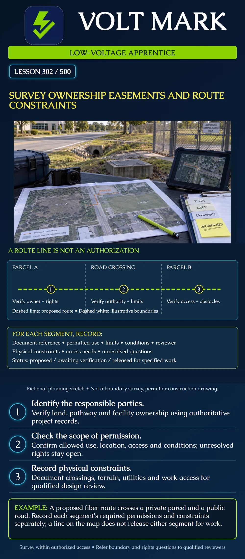
The lime dashed line represents a proposed route. It passes through Parcel A, a road crossing and Parcel B. The white dashed lines are illustrative divisions, not established legal boundaries. The three numbered points prompt separate checks: owner and rights; road authority and crossing limits; access and obstacles. The drawing contains no width, depth or clearance because those must come from the actual design and applicable requirements.
A planning map labels a strip “utility easement.” The apprentice records the map source and asks for the governing document and responsible review. Until the intended fiber use and proposed location are verified, the segment remains awaiting verification. The label alone does not establish who may build, where equipment can stage or how maintenance access will work.
A property owner approves work on the private parcel, but the proposed route continues across a road. Record the road segment separately and identify its controlling authority and review process. Do not extend the private approval by assumption. The lesson supplies no universal crossing permit, construction method or waiting period.
A drawing shows an existing duct along the desired path. Ownership, occupancy, condition and permission to use it remain unverified. Record those questions for the responsible team. Do not call the duct available merely because it appears on a drawing or because a nearby enclosure can be seen. Opening, entering or testing facilities requires the appropriate authorization and work procedure.
From authorized observations and records, note terrain, drainage, road or rail crossings, building entrances, visible utilities, known underground facilities and potential environmental or cultural constraints. Identify room for equipment, cable reels, splicing activity, storage and later maintenance access. Distinguish observed conditions from reported information and assumptions. Route-survey notes do not replace utility-location requirements, which the next lesson addresses.
For each segment include:
The output is a documented route candidate with known constraints and open questions. It is not automatically a released construction drawing. The responsible team must reconcile rights, engineering requirements and applicable approvals. If a segment changes, review the affected permissions and constraints again; approval for one alignment should not be assumed to cover an altered route.
A fictional route crosses Parcel A, a road and Parcel B. The file contains an approval limited to the proposed work on Parcel A, a map marked utility easement on Parcel B, and an old duct drawing through the road. Create three segment records with evidence, unresolved questions and next action. Do not choose a construction method. Expected reasoning: retain the Parcel A document and have its limits and conditions checked against the current alignment. Record the road authority, crossing authorization and duct ownership, occupancy and condition as unconfirmed. For Parcel B, request the governing easement document and review of the proposed use rather than treating the map label as permission. Assign each open question to a responsible project role. The combined route remains a candidate until the required reviews and approvals are resolved; one segment's evidence does not release the others.
[1] Fiber Optic Association, Outside Plant Fiber Optic Network Design, route planning and GIS sections. Accessed 2026-10-01. Used for route investigation concepts, not generic dimensions, component prescriptions or installation methods. https://www.thefoa.org/tech/ref/OSP/design.html [2] Bureau of Land Management, Rights-of-Way. Accessed 2026-10-01. Used as a specifically identified federal-land example, not a rule for every jurisdiction or land type. https://www.blm.gov/programs/lands-and-realty/rights-way
Texas journeyman, 15 questions, scored by topic against the 70% mark. No card, and no account needed to start.
Free study material for low-voltage apprentices. This is a national foundation course: requirements differ by state and by local jurisdiction, and a practice that is common in one place is not a rule everywhere. Nothing here is a licence, a certification, or authority to work unsupervised, and completing it does not count as apprenticeship hours or continuing-education credit. Check the codes adopted where you are working, the licensing authority for that work, and your employer's safety programme. VoltMark is not affiliated with, endorsed by, or sponsored by NFPA, OSHA, NICET, BICSI, FOA, or any state or local licensing authority.

Electrician licensing exam prep: practice questions, timed exam simulations, and step-by-step help finding every answer in the NEC.